There are several neighbouring countries of India, making its geographical location strategically significant. From China and Pakistan to Bangladesh and Nepal, these neighboring nations shares border with India, influence India’s diplomacy, trade, and regional dynamics.
In this blog post, we’ll explore 9 neighbouring countries of India and their capitals, their geographical significance that will be crucial for your exam.
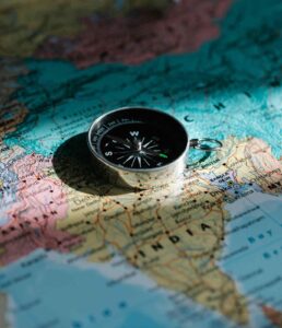
Neighbouring Countries of India
International Land Borders –
- Pakistan
- Afghanistan
- China
- Nepal
- Bhutan
- Myanmar
- Bangladesh
International Maritime Border –
- Sri Lanka
- Maldives
Important Points –
- Longest International boundary shared with India is Bangladesh which is (4096.7 km).
- Second longest international boundary shared with India is China (3488 km).
- With Pakistan, India shared 3323 km.
- Smallest international boundary shared with India is Afghanistan (106 km).
- With Bhutan, India shared 669 km.
- With Nepal, Inda shared 1751 km.
- With Myanmar, India shared 1643 km.
India and its Neighbouring Countries
Bangladesh –
- Capital – Dhaka
- Currency – Taka
- Prime Minister – Sheikh Hasina
- President – Abdul Hamid
- National Anthem – ‘Amar Sonar Bangla. Ami Tomay Bhalobashi’ (Written and composed by Rabindranath Tagore).
- Language – Bengali
- National Sport – Kabaddi
- Independence Day – 26th March (from Pakistan)
- Parliament – Jatia Parliament/ Jatiya Sangsad
- National Flower – Water Lily
- National Fruit – Jackfruit
- National Tree – Mango Tree
- National Bird – Magpie Robin
- National Animal – Royal Bengal Tiger
- National Fish – Ilish
- Bangladesh shares border with India and Myanmar.
- India – Bangladesh Border –
- Bordering states – West Bengal, Assam, Meghalaya, Tripura, and Mizoram. (5 states).
- Border Length – 4096.7 km
- Border name – Radcliff Line.
CHINA –
- Capital – Beijing
- Currency – Renminbi (Yuan is its basic unit)
- President – Xi Jingping
- National Anthem – March of the volunteers
- Language – Mandarin (dialect of Chinese)
- Parliament – National People’s Assembly
- Independence Day – 1 October 1949 (Officially People’s Republic of China)
- National Flower – Plum Blossom
- National Fruit – Kiwi, Jujube
- National Tree – Gingko
- National Bird – Red-crowned crane
- National Animal – Giant Panda, Chinese Dragon.
- India – China Border –
- Bordering states – Ladakh, Himachal Pradesh, Uttarakhand, Sikkim, and Arunachal Pradesh (5 states).
- Border Length – 3488 km
- Border Name – Line of Actual control (LAC) with Ladakh and McMahan Line with Arunachal Pradesh.
PAKISTAN –
- Capital – Islamabad
- Currency – Pakistani Rupee
- Prime Minister – Anwaar-ul-Haq (8th caretaker PM)
- President – Arif Alvi
- National Anthem – Qaumi Taranah
- National Language – Urdu
- National Sport – Hockey
- Parliament – National Assembly & Senate
- National Flower – Common Jasmine
- National Fruit – Mango (Summer) and Guava (Winter)
- National Tree – Himalayan Cedar
- National Bird – Chukar Patridge
- National Animal – Markhor
- Pakistan shares border with India, Afghanistan, Iran.
- India – Pakistan Border –
- Bordering states – Jammu & Kashmir, Ladakh, Punjab, Gujarat and Rajasthan (5 states).
- Border Length – 3353 km
- Border name – Line of control, Radcliffe Line
AFGHANISTAN –
- Capital – Kabul
- Currency – Afghani
- National Anthem – Milli Surood
- Official Language – Pashto and Dari
- National Sport – Buzkashi
- Independence Day – 19th August 1919
- Parliament – Shora
- National Flower – Tulip
- National Fruit – Pomegranate
- National Tree – Afghan Pine
- National Bird – Golden Eagle
- National Animal – Snow Leopard
- India- Afghanistan Border –
- Bordering State – Ladakh
- Border Length – 106 km
- Border Name – Durand Line
NEPAL –
- Capital – Kathmandu
- Currency – Nepalese Rupee
- Prime Minister – K.P. Sharma Oli
- President –
- National Anthem – Woven from hundreds of flowers
- Language – Nepali or Nepalese
- National Sport – Volleyball
- Parliament – Sanghiya Sansad/ Federal Parliament of Nepal
- National Flower – Rhododendron (Laliguras)
- National Tree – Ficus Religiosa (Peepal)
- National Bird – Himalayan Monal
- National Animal – Cow
- Nepal shares border with India and China
- India – Nepal Border
- Bordering states – Sikkim, West Bengal, Bihar, Uttar Pradesh and Uttarakhand (5 states).
- Border length – 1751 km
BHUTAN –
- Capital – Thimphu
- Currency – Bhutanese Ngultrum
- Prime Minister – Lotay Tshering
- Monarch – Jigme Khesar Namgyel Wangchuk
- National Anthem – Druk Tsenden
- Language – Dzongkha
- National sport – Archery
- Parliament – Tshogdu
- National Flower – Himalayan Blue Poppy
- National Tree – Himalayan Cypress
- National Bird – Raven
- National Animal – Takin
- Bhutan shares its border with India and China
- India – Bhutan Border –
- Bordering states – Arunachal Pradesh, Assam, Sikkim and West Bengal (4 states).
- Border length – 699 km
MYANMAR –
- Old Name – Burma
- Capital – Naypyitaw
- Currency – Kyat
- State Head – Min Aung Hlaing
- National Anthem – Kaba Ma Kyei
- Language – Burmese
- Parliament – Pyidaungsu Hluttaw / Assembly of the Union
- National Flower – Padauk
- National Bird – Green Peafowl
- National Animal – Tiger
- National Sport – Chinlone
- India – Myanmar Border –
- Bordering states – Arunachal Pradesh, Manipur, Mizoram, and Nagaland (4 states).
- Border length – 1643 km
SRI LANKA –
- Capital – Colombo (Executive and Judicial capital), Sri Jayawardenepura Kotte (Legislative capital).
- Old Name – Ceylon
- Currency – Sri Lankan Rupee
- National Anthem – Sri Lanka Matha
- Language – Sinhala and Tamil
- National Flower – Blue water lily
- National fruit – Jackfruit
- National tree – Ceylon ironwood
- National Bird – Sri Lankan Jungle fowl
- National Sport – Volleyball
- Sri Lanka shares maritime borders with the Maldives and India
- Sri Lanka situated on Indian Ocean, Southwest of Bay of Bengal and southeast of Arabian sea.
- It is separated from Indian subcontinent by Gulf of Munnar and Palk strait
MALDIVES –
- Capital – Male
- Currency – Maldivian Rufiyaa
- National Anthem – Qaumee Salaam
- Language – Dhivehi
- Parliament – People’s Majis
- National Flower – Pinkrose
- National Fruit – Coconut
- National Tree – Coconut Palm
- National Bird – White-breasted waterhen
- National Animal – Yellowfin Tuna
- National Sport – Bashi & Football
- Maldives is situated in the Indian Ocean
- Maldives lies southwest of Sri Lanka and India.
Neighbouring Countries of India and States of Assam
- Assam is located in the tropical latitudes (24.3 N and 28 N) and eastern longitudes (89.5 E and 96.1 E).
- Assam has an area of 78,438 sq. km representing 2.39% of the total area of the country.
- According to area 16th largest states
- Assam has a population of 31,205,576 (2011) accounting for 2.59% of the total national population.
- According to population Assam is the 15th largest.
- Assam has as of 31 districts (2023).
- Assam has 2 Neighbouring countries (Total – 533.3 km length shared) –
- Bhutan (265.8 km length shared)
- Bangladesh (267.5 km length shared)
- Assam has shared her boundary 7 Indian states (Total – 2741.3 km length shared) –
- Arunachal Pradesh (804.1 km length shared)
- Nagaland (512.1 km length shared)
- Manipur (204.1 km length shared)
- Mizoram (164.6 km length shared)
- Tripura (46.3 km length shared)
- Meghalaya (884.9 km length shared)
- West Bengal (127 km length shared)
- Highest Boundary shared with Assam is Meghalaya in India.
- Smallest Boundary shared with Tripura in India.
- Dhubri (Kurigram Sector), Cachar (Sylhet sector), Karimganj (Moulavi Bazar sector) districts of Assam shared its border with Bangladesh.
- Kokrajahar, Chirang, Bakasha, Udalguri districts of Assam shared their border with Bhutan.
1) Assam – Arunachal Pradesh Border –
- Total Length – 804.1 km
- Charaideo, Uadalguri, Sonitpur, Biswanath, Lakhimpur, Dhemaji, Tinisukia, Dibrugarh (Total -8) districts of Assam shared their border with Arunachal Pradesh.
2) Assam – Nagaland Border –
- Total Length – 512.1 km
- Sivasagra, Charaideo, Jorhat, Golaghat, Dima Hasao, Karbi Anglong (Total -6) districts of Assam shared their border with Nagaland.
3) Assam – Manipur Border –
- Total length – 204.1 km
- Dima Hasao, Cachar (Total -2) districts of Assam shared their border with Manipur.
4) Assam – Mizoram Border –
- Total Length – 164.6 km
- Cachar, Hailakandi, Karimganj districts of Assam shared their border with Mizoram.
5) Assam – Tripura Border –
- Total length – 46.3 km
- Karimganj district of Assam shared its border with Tripura.
6) Assam – Meghalaya Border –
- Total length – 884.9 km
- Dima Hasao, Cachar, West Karbi Anglong, Morigaon, Kamrup (M), Kamrup, Goalpara, Dhubri, South Salmara Mankachar (Total – 9) districts of Assam shared their boundary with Meghalaya.
7) Assam – West Bengal Border –
- Total Length – 127 km
- Dhubri, Kokrajhar (Total-2) districts of Assam shared their border with West Bengal.

